Tuesday, November 29, 2011

Upper Paugussett State Forest


Date: November 29, 2011
Report Type: TA Report:
Trail Name: Upper Paugussett State Forest
Town: Newtown
Trail Conditions: Good

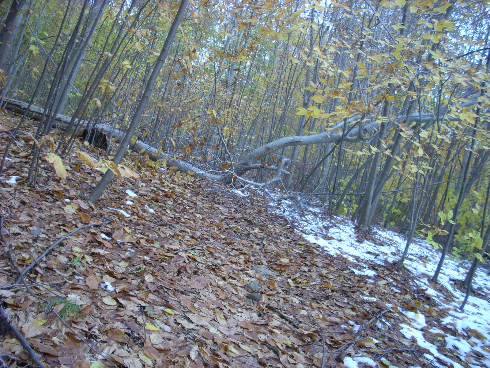
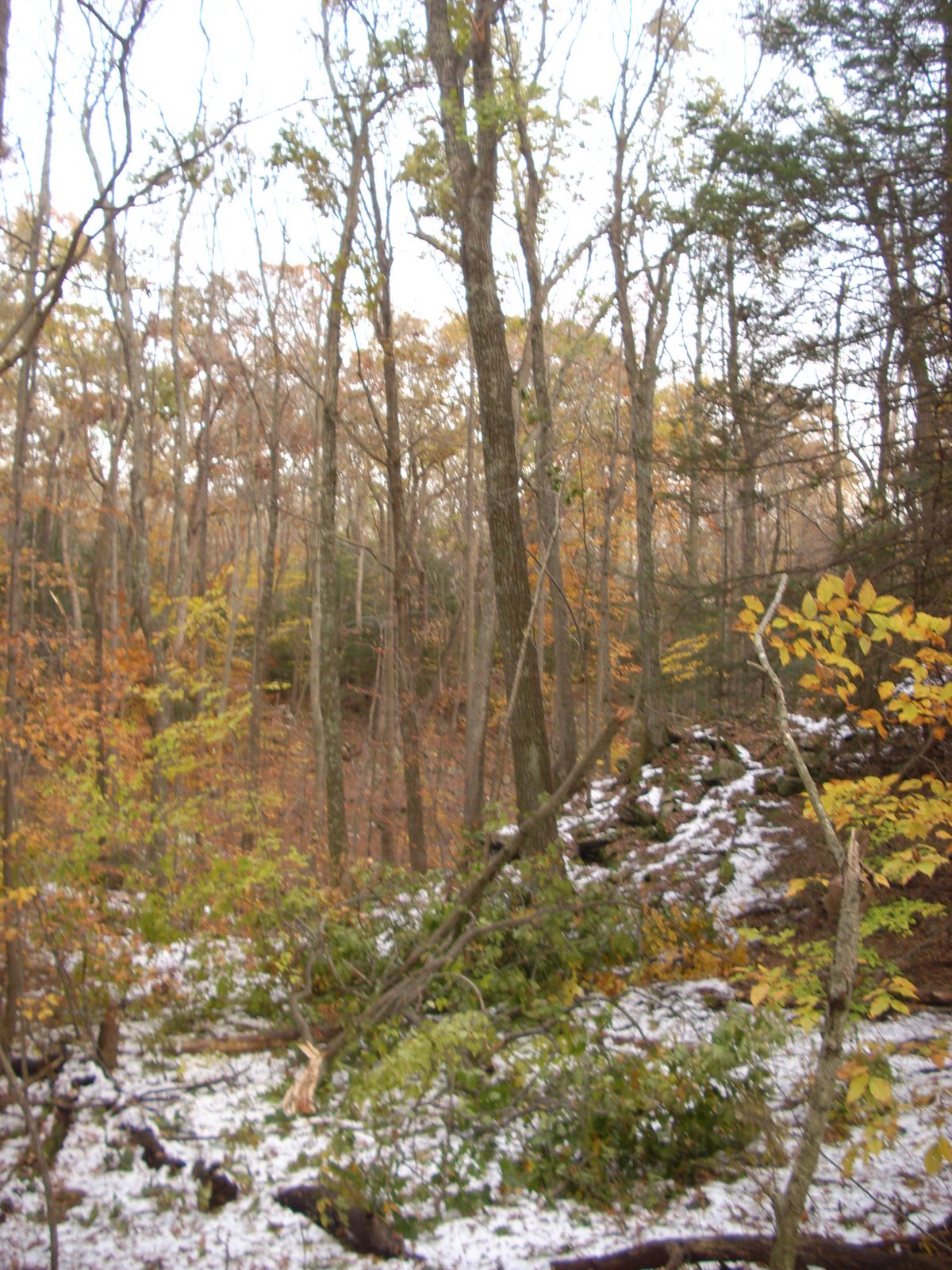
Observations/Information: I snuck in a quick up and back before the rain on Tuesday and had the woods to myself. The air was warm and tropically humid, and, although it hadn't rained yet, the rocks, logs, and leaves had become wet by condensation. Slick, leaf-shrouded roots and rocks, combined with a 29er single speed with 32x19 gear and cheap wire bead, low-traction rear tire made for a challenging ride, especially on the way up.

The trail was in good shape, although storm-weakened limbs continue to fall. There was nothing across the trail that couldn't be ridden right over. I also noticed some post-holing in places, probably horses. There's an old lawn chair at the bottom of the trail, making it easier to find. The leaves are down too, of course. The trail was generally not hard to follow although I missed the reroute on the way down. I cleared several large sticks off the trail and one pile of horse poop that gave me an opportunity to practice my golf swing.

Trail Ambassador Name: Glenn Vernes

Monday, November 28, 2011

TM Report: Cockaponset SF - Weber Woods section


Date: November 28, 2011
Report Type: TM Report:
Trail Name: Cockaponset SF - Weber Woods section
Town: Clinton/Westbrook/Deep River
Trail Conditions: Good shape with usual mud areas
Observations/Information: I wanted to get in a decent ride and also clear that downed tree on the unmarked by the beaver pond; warmed up on the western dirt road then on to the southern green; about a hundred yards in I came across a women and two dogs covered in orange blaze; one dog flew towards me and the woman kept screaming "Carly, no bite...Carly, no bite..." at the top of her lungs- not what a biker wants to hear; I slowly rode by them all with no incident; rode a few on the interior trails, then headed over to the northern green south to the unmarked which was blocked by the tree; it had quite a few thick limbs that were a pain to cut with a hand saw, then drag into the woods; on a break I took a look at what broke the tree eight feet off the ground- beaver work at the base which weakened it causing the snap; this made sense because the trail comes within 20 feet from the pond; it took a while to cut and drag the limbs off, and it was dark by the time I finished;


I got on my bike, cranked on my Magicshine to take an "after" photo when a loud smack on the water's surface 30 feet away actually caused me to jump; I could see in the moonlight large ripples in the water; after a couple more whacks I realized I was having my first encounter with a beaver and he was trying to scare me off- very cool; packed my stuff and headed out with my light beam leading the way; got back home feeling pretty good about my experience and the fact that the last tree blocking a trail at WW was now cleared. 
Trail Ambassador Name: Don Hazuka

West Rock Ridge SP

Date: Nov. 28, 2011
Report Type: TM Report:
Trail Name: West Rock Ridge SP
Town: Hamden
Trail Conditions: Generally clear, but muddy in spots
Observations/Information: As a reminder, be sure to do a tick check and take a shower as soon as you arrive home. Yesterday, I pulled a tick off my back that looks like a female deer tick (the bad kind that carry Lyme Disease). I most likely picked up this tick while helping my brother clear some invasive plants from his yard (No good deed goes unpunished), and did only a quick tick check afterwards, and held off on the shower because I was road biking later on. I brought the tick to the Milford Health Dept. (where I live), which is sending it to the state Department of Health for testing (no charge to me). In the meantime, I will watch for symptoms, and any changes to the bite area. Fortunately, the tick came out easily and did not look like it had begun to feed. When I came back from this trail session, I did my tick check and headed straight for the shower. No ticks.
Back to my trail report. I did a circuit on mostly non-biking trails to continue the storm cleanup. Trails generally were clear, other than some minor blowdowns. I walked the White Trail from Purple back to Lake Wintergreen. There are numerous muddy spots, plus some soggy areas, and the watercourse at White and Purple had some water in it. Until I get around to doing a reroute in 2012, be prepared to get muddy. This trail violates the major principles of sustainable trail design as I learned from IMBA. The surface is soft, organic matter. The trail is laid out at the bottom of the ridge on flat ground with no place for water to run off.
Trail Ambassador Name: Tom Ebersold

Sunday, November 27, 2011

TM Report: Wilton Woods

Date: 11/27/11
Report Type: TM Report:
Trail Name: Wilton Woods
Town: Wilton
Trail Conditions: wet
Observations/Information: cleared the last of the trees and armored the red trail
Trail Ambassador Name: dave Francefort

Collis P Huntington SP

Date: November 27, 2011
Report Type: TA Report:
Trail Name: Collis P Huntington SP
Town: Redding
Trail Conditions: Mud in the low places, otherwise fine.
Observations/Information: Hit Huntington Sunday afternoon. Trails are in fine shape, although there is mud in the low-lying areas, and also a lot of dog doo, so be on the lookout for that. Some of the trails have been blown clear of leaves, and those that haven't have had the leaves well packed and are easy to follow. A rudimentary plank bridge has been created around the fallen tree that is blocking the boardwalk, so that area is rideable again.

I encountered a group of freeriders at the new roll down on South Pond, and showed then how to ride it. There I was, a hardtail-riding xc weenie schooling freeriders on how to ride a roll-down!

Get out and ride Huntington before it rains again on Tuesday. Just stay out of the mud, please, and watch out for dog doo.

Trail Ambassador Name: Glenn Vernes

Nehantic SF

Date: Nov 27, 2011
Report Type: TA Report:
Trail Name: Nehantic SF
Town: East Lyme
Trail Conditions: leafy
Observations/Information: So, hooked up with Steve and Cory last night and we decided to do a little exploring back in the Nehantic State Forest. After the last few time I metioned it might be better to just park where the trails-road crosses Grassy Hill Rd. Glad we did as it cut off a few miles of boring-ish nasty fire road riding. We basically rode all the way down to the end of Nehantic and rode more on the Yale property. there are a good amount of trees down from the storm[s] and many a wet spot. I think We hike-a-biked as much as we actually rode but we had a good time.. plenty of exercise that's for sure!
there is some really nice sections, and some really nasty mud bogs, but the place has real potential!!


EveryTrail - Find the best biking in Connecticut

Trail Ambassador Name: thom Lamourine
Trail Ambassador E-mail: thom1{at}ctnemba{dot}com
How did you use the trail? MT Biking
Trails Ridden: unknown heaaaahaahaaa

Collis P Huntington SP


Date: 11/20/11
Report Type: TM Report:
Trail Name: Collis P Huntington SP
Town: Redding
Trail Conditions: Good
Observations/Information: We were on a mission to finish cleaning up the brush from the storm. We had permission to drive down to south pond through the park and that took quite a while since we had to clear as we went. The carriage roads to the south pond are now clear. We worked on the new section of trail too, removing flags, blowing leaves and exposing a new roller. Then we headed over to Burned Loops. A number of big trees were blocking the lower loop, so we did a couple of short reroutes. Folks were riding all over the place to get to some of the features.
    

Hopefully, they will stay on the new reroutes. A good day!It is great to have riders come by and want to help. FCNEMBA ( Tuckers, and a few others) and Glenn Vernes were there too for a total of six people.


Trail Ambassador Name: Paula Burton

TM Report: Pole Bridge Preserve


Date: 11-13-11
Report Type: TM Report:
Trail Name: Pole Bridge Preserve
Town: Newtown
Trail Conditions: ok
Observations/Information: Great turn out to work on trail building today. We had a bunch of volunteers from Sandy Hook Elementary School show up, mini-rakes in hand. I need to addd a few to my tool crib! We cleared and raked and did some benching. And everyone enjoyed the cider and donuts after.


Trail Ambassador Name: Paula Burton

Saturday, November 26, 2011

TM Report: Wilton Woods

Date: 11/26/11
Report Type: TM Report:
Trail Name: Wilton Woods
Town: Wilton
Trail Conditions: Wet
Observations/Information: Worked on the large tree across the blue trail by the boas lane lot...30+ inch tree quite the challenge....but nearly done
Trail Ambassador Name: Dave Francefort

2011 Turkey Burner at Case Mountain


The Intermediate Route

Thursday, November 24, 2011

Rocky Neck State Park

Date: Nov 24, 2011 THANKSGIVING DAY!!
Report Type: TA Report:
Trail Name: Rocky Neck State Park
Town: East Lyme
Trail Conditions: lightly moist, the usual wet spots after the recent rain
Observations/Information: Went to do a quick ride before going to visit my brother at his in-laws house for turkey. Some of the usual wet spots had moisture but weren't as bad as I thought it would be after the amount of rain we got Tuesday night and Wednesday. Had Alice's Restaurant jammin in my ears during the ride which s a Thanksgiving day tradition. made a video with Arlo Guthrie jammin for those that didn't get to listen to the Thanksgiving story :)

2 Turkey Traditions combined... the video ride

Trail Ambassador Name: Thom Lamourine

Cockaponset SF - Weber Woods section

Date: November 24, 2011
Report Type: TA Report:
Trail Name: Cockaponset SF - Weber Woods section
Town: Clinton/Westbrook/Deep River
Trail Conditions: Slow with wet low spots
Observations/Information: Headed out to burn come calories before the big gorging; dressed light figuring I would warm up quickly and was right; the leaves are flattening down due to the rain, but I had to walk around some pretty nasty wet, mud holes; overall the trails were in pretty good shape considering the weather over the past few months; did parts of most everything, but now the beavers have completely flooded the land around the feeder stream bridge on the white trail which is impassible for now;
about half an hour into the ride I realized I forgot my Gore beenie and a well vented helmet means a chilly skull this time of year; took the nice unmarked south off the upper green and came across a newly fallen limb by the swamp blocking the trail-
need to also remember my hand saw; took the red to the blue to the green for some leg work and then on home to prepare for the chow down; didn't see anyone the whole time; beautiful day, I'm glad I snuck this one in.
Trail Ambassador Name: Don Hazuka

Hop River State Rail Trail

Date: Nov 24, 2011
Report Type: TA Report:
Trail Name: Hop River State Rail Trail
Town: Vernon-Bolton
Trail Conditions: Excellent
Observations/Information: The 3rd Annual Steele's Crossing Bike Ride featured (29) mountain bikers. Our group traveled along the Hop River Rail Trail. We departed from RT 30 in Vernon @ 8:00 am. It was a chilly start (32 degrees) with bright sunshine, a wonderful Thanksgiving morning. The trails in excellent condition!! Many "thanks" to the local volunteers and paid workers that maintain this area. Happy Thanksgiving to all.
Trail Ambassador Name: Peter Blume

TM Report: Airline Trail

Date: 11/24/11
Report Type: TM Report:
Trail Name: Airline Trail
Town: Wilton
Trail Conditions: Damp
Observations/Information: Continued trail clearing of trees and branches
Trail Ambassador Name: David Francefort

George C Waldo State Park

Date: November 24, 2011
Report Type: TA Report:
Trail Name: George C Waldo State Park
Town: Southbury
Trail Conditions: Good
Observations/Information: Paula and I traditionally ride on Thanksgiving Morning. This year, we rode Waldo. We crossed paths with two other riders, including a guy from New Hampshire who was visiting the area. He liked the trail. Trails were amazingly dry considering the recent rain. The dirt road was a little wet, as was the bottom of the Hunter's Trail. Everything else was dry. The leaves were a little wet, though, especially on the shady hillsides, and it made for slippery conditions. The leaves were well packed on the trail and it was easy to follow.

Waldo would be a great place to ride this weekend.

Trail Ambassador Name: Paula Burton, Glenn Vernes

Tuesday, November 22, 2011

Rocky Neck State Park

Date: Nov 22, 2011
Report Type: TA Report:
Trail Name: Rocky Neck State Park
Town: East Lyme
Trail Conditions: Leafy
Observations/Information: Trails were nice though very Leafy! Going to be a few mud spots after the rain tonight. Ran into the Maintenance folks and stopped for a chat. They are resetting the edge of the beach to repair/replace the boardwalk that washed away during the storm this summer and finish it down to the train track underpass. little chilly but nice once I got moving.
Trail Ambassador Name: Thom Lamourine

Sunday, November 20, 2011

Hop River State Rail Trail

Date: Nov 20, 2011
Report Type: TA Report:
Trail Name: Hop River State Rail Trail
Town: Vernon-Bolton
Trail Conditions: Outstanding!
Observations/Information: Three weeks since Storm Alfred and the Hop River is in fantastic condition. All blow-downs and branches have been removed. Vernon Parks & Rec cleared leaves off the trail this past week. The regular trail users (joggers, bikers, hikers and even a man on horseback) were out early today enjoying the 60 degree day. *NOTE OF CAUTION: There are still clusters of branches tangled high above the trail. These will eventually fall down with wind gusts and snow. Please exercise caution when riding at night or during blustery conditions. Happy Thanksgiving to all.
Trail Ambassador Name: Peter Blume

Collis P Huntington SP

Date: November 20, 2011
Report Type: TA Report:
Trail Name: Collis P Huntington SP
Town: Redding
Trail Conditions: Good, but leafy
Observations/Information: Paula and I did a quick ride after the trail work on Sunday. We were joined by a dude from FC NEMBA named Jeremiah. We rode the Burn Loop, Old Mine, and Twister. Trails were in very good shape, dryer than expected (just a little bit of dryish, gooey mud in the low places), but covered in a thick blanket of leaves that hide the notorious embedded rocks. The trees are in full deciduous nudity mode now, and the leaves have migrated to the ground. Trails were also completely passable, most blowdowns have been cleared, and any remaining have new lines around them. The boardwalk trail is still a litle wet and should be avoded. There's also a tree across the boardwalk that renders it impassible.

The trails of Huntington are definitely harder to ride with the leaves hiding the rocks, and a little harder to follow too. Get out and ride Huntington before it rains on Wednesday.
Trail Ambassador Name: Paula Burton, Glenn Vernes

Saturday, November 19, 2011

TM Report: West Rock Ridge SP

Date: Nov. 19, 2011
Report Type: TM Report:
Trail Name: West Rock Ridge SP
Town: Hamden
Trail Conditions: Dry with some blowdowns
Observations/Information: In past postings, I have discussed work I have done on removing invasive plant species and people may wonder what does that have to do with mountain biking. This photo of a dead, fallen tree wrapped with vines shows the answer: everything. Vines weaken and kill trees, and then they can fall on the trail. I spent time on the Red Trail up to the "Hang Glider" overlook, and the Red-White Trail from the Hill St. parking area out to the Gravel Road clearing blowdowns from the October blizzard. There were numerous small blowdowns from tree crowns along both trails. One hiker who passed me on the Red-White Trail looked at my handsaw and said that I was not going to be able to clear the blowdowns with just that saw. A couple of hours later with decidedly sore arms, the job was done. I encountered a couple of mountain bikers who were headed up to the Red Trail, so they were pleased to hear that I had just cleared it. I asked them about the Red Trail heading down to Lake Wintergreen where I reported four large trees to the state. They said the trail was clear. As I walked back to Hill Street in the rapidly fading light along the Red Trail where it's a gravel road, I opened up one blowdown a bit more, cleared a second one, and steered clear of a third tree that was totally wrapped with poison ivy. I'm still clearing out the case I caught two weeks ago while working on the vines on Baldwin Drive. I'll report those blowdowns to the state. In the open field, I cut back some autumn olive (another invasive) that was encroaching upon the trail. The trail surfaces were generally dry and firm, excepting the part near the pond where an armoring project is on my list of trail repairs.
Trail Ambassador Name: Tom Ebersold

TM Report: Wilton Woods

Date: 11/19/2011
Report Type: TM Report:
Trail Name: Wilton Woods
Town: Wilton
Trail Conditions: Dry
Observations/Information: Worked on clearing a 2 foot diameter tree that was up rooted and was blocking the trail, 2 hours of chain sawing and the trail is back open. Then proceeded to Boas lane to begin work on cutting up another verg large tree
Trail Ambassador Name: Dave Francefort

Tuesday, November 15, 2011

George C Waldo State Park

Date: November 15, 2011
Report Type: TA Report:
Trail Name: George C Waldo State Park
Town: Southbury
Trail Conditions: Perfectly clear!
Observations/Information: I managed to get a quick ride at Waldo in before the sprinkles on Tuesday. The sky was dank and gray, the forest floor a brown monochrome of leaves, devoid of shadows. This made the riding more difficult, and the trail harder to follow. The Where's Waldo Trail is now completely clear from end to end, including the extra credit loop. The widowmakers are all down, and have been cleared, as has the blowdown on the final descent. Thanks to whomever did that. I cleared the one at the Hunter's Trail turnoff myself. There are currently several lines at that location and following the trail is a little difficult. The second widowmaker had fallen and, although it didn't block the trail, it did encroach on it a little, so I trimmed it back. The Daffy Duck Trail is also clear. The leaves are now almost completely down, and traction is sketchy in turning, climbing, and braking, a sensation not unlike riding on ice. The trail is also a little hard to follow in places. Trails are dry from start to finish, for the time being anyway.

One of the hardest things about riding this time of year is figuring out what to wear. I had started the ride with a jacket and glove liners, but I quickly became too hot and relegated them to my pack. I finished in shorts and a tee shirt- not bad for mid-November.


Trail Ambassador Name: Glenn Vernes

Cockaponset SF - Weber Woods section


Date: November 15, 2011
Report Type: TA Report:
Trail Name: Cockaponset SF - Weber Woods section
Town: Clinton/Westbrook/Deep River
Trail Conditions: Leaf covered, slow, fairly dry
Observations/Information: I noticed a lot of trees behind my house had blue streaked paint on them, and the numbers were increasing over the last couple of weeks- I contacted the DEP and found out they are preparing for a timber sale; there was a sign recently posted stating this and I saw a DEP truck parked at the green trailhead;
most of the trails were in pretty good shape, but the downed leaves are keeping the moisture in; I took the southern green east and did most of the interior trails; I came across a couple of trees down from the recent storm- one each on the orange near the second foot bridge, and on the blue just up the hill from the old wooden bridge; there were a couple of vehicles parked in the east lot, but saw no one; on the yellow, the beavers were not content with flooding that trail a couple of years ago, so they were at it again;
   
 the detour that was just gettin worked in and had nice flow is now water covered in two spots- frustrating; this time of year is like riding through a mine field with the leaves not yet flattened so the rocks and horse divets are hidden from view; nice weather, nice ride.

Trail Ambassador Name: Don Hazuka

Roosevelt Forest

Date: 11/15/11
Report Type: TA Report:
Trail Name: Roosevelt Forest
Town: Stratford
Trail Conditions: Leaf covered, at times slick
Observations/Information: Trails had a ton of leaves covering them, at times making for slick conditions. Forest was pretty dry except for a minor stream crossing. When I went into the forest, I shared the forest with a man and his dog. When I came out of the forest I was greeted by several K-9 police vehicles from the following towns: Darien, Stratford, Monroe and others, the sound of dogs barking filled the air, the sight of police cars with engines running and lights ablaze filled the parking lot, and K-9 police officiers with protective gear standing around. A Police K-9 training was in progress. I was glad to see the one dog, a big german shepard, tethered to a strong leash, held tight by its officer/handler. I left without incident.
Trail Ambassador Name: Ed Perten

Monday, November 14, 2011

TA Report: Upper Paugussett State Forest


Date: 2011-11-13
Report Type: TA Report:
Trail Name: Upper Paugussett State Forest
Town: Newtown, CT
Trail Conditions: Awesome, now!

Today's route

Observations/Information: I ventured up the Poly Brody this afternoon to find it completely opened up! Looks like the State came in, evidenced by the truck tires in the mud.  It's a little wet in places but alas back to a means to an end.


I met these hikers snacking at the intersection with the white trail, which is thoroughly blocked by the way, and the leader of the group asked for directions to the Lake Trail (aka Al's Trail) back to Pond Brook.  I pointed them in the direction they needed to go.


However, there were blockages on the Gussy still that took care of, three major problem that my little TA handsaw took care of in a jiffy.  I think I mentioned this earlier but the Fall Line descent to the Taco Stand is closed so I blocked it off today.  Hopefully people will respect that.  Eventually the trail will go back that way but that's yet another idea in the offing which might even include a quasi/ad hock pump track!  Probably a next year project.


The Gussy is completely opened, a little leafy in places but very, very rideable. The reroutes that I did the other day need a little more work because they are still too soft.


I need to do another re-route on the flat area after you climb up from the last stream crossing to improve the the flow. The trees that came down in that section make the turn kind of tight, it has always been this way, but with the trees down it's now the next project.  In fact a local bike shop whose owner loves riding the Gussy now wants to plan a trail building session so stay tuned for details on that.

Trail Ambassador Name: Mark Lurie

Sunday, November 13, 2011

Oswegatchie Hills

Date: Nov 13, 2011
Report Type: TA Report:
Trail Name: Oswegatchie Hills
Town: East Lyme
Trail Conditions: Leafy
Observations/Information: Have to go there once a year to remind myself why I only go there once a year :)

Trails are good, It seems though that a bunch of sections have been moved for more interesting hiking terrain but much less friendly Biking. There were areas of the Red trail you could just stay on the ridge where now yo have to go up and down 3 -4 times and it's not really a safe riding experience. Still a cool place when you got out back on the blue trail. Only problem is the close the eastern section of the blue trail for hunting.. soo you have to take the orange trail.. which 80% isn't rideable. :( Still had a good time out in the woods, even if it was mostly hike-a-bike!

GPS track...
GPS track of Oswe

Trail Ambassador Name: Thom Lamourine

Saturday, November 12, 2011

TM/TA Report: Hop River State Rail Trail

Date: Nov 12, 2011
Report Type: TA Report:
Trail Name: Hop River State Rail Trail
Town: Vernon, Bolton, Andover
Trail Conditions: Fair
Observations/Information: It has been a tough 2 weeks in the Vernon area....powerless for 9 days! The October storm damaged so many trees along the Hop River Trail. Pedal Power (Vernon) organized a "trail clean-up day". Safety helmets, bow saws and loppers were borrowed from the Vernon Parks and Recreation Dept to aid in this task. Twelve members from the LTRA biking group pitched in to help, including TA's Peter Blume and Mike Lefevre. A section crossing RT 30 headed to Center Rd. has been cleared of branches and downed trees less than 6" in width. The town will take care of all trees larger. This 2 mile area was cleared in 2 hours with 35 volunteers!
The Thread City Cyclers (TCC) from Willimantic worked their way from Bolton Notch down to Valley Falls. Chain saws and many hands helped clear major blow-downs. The trail is ride worthy, however.....PLEASE EXERCISE CAUTION!! Many trees/branches are still hanging over the trails. As winds pick up it is sure to leave debris along the way. Night riders please slow down speeds and have bright lights to help your visibility. The efforts by the community are appreciated!
After the work, our bikers enjoyed a ride to Burnap Brook.
Trail Ambassador Name: Peter Blume

Wilton Woods

Date: 11/12/11
Report Type: TM Report:
Trail Name: Wilton Woods
Town: WIlton
Trail Conditions: leafy, dry
Observations/Information: Still more trees to clear, managed to do half of back blue and orange and white.
Trail Ambassador Name: David Francefort

West Rock Ridge SP

Date: Nov. 12, 2011
Report Type: TM Report:
Trail Name: West Rock Ridge SP
Town: Hamden
Trail Conditions: Generally dry with some blowdowns
Observations/Information: I rode my bike and took along a handsaw to review post-snowstorm damage. I rode the entire White Trail. There were a few minor blowdowns that I cleared. I also rode the Red Trail, which was clear along Lake Wintergreen, and up to the Purple Trail. From the Purple Trail to the evergreen tunnel there were three major blowdowns, and two medium-sized ones. I took care of the two medium-sized ones, and let the state know about the other tree, so they will come in with chainsaws to take care of them. The trail is passable, but you have to lift your bike over the trees. There were a few minor blowdowns on the Red Trail between the two sections of Mountain Road, which I cleared. There is one large one about one-quarter mile south of the northern end of Mountain Road. I cut an 8-inch tree away with my handsaw, impressing a mountain biker who came upon me. I will let the state know about the 12-inch tree. It's too bad people are already cutting a path around it, which will only increase erosion. I encountered a man carrying a chainsaw, who was clearing a blowdown on the Purple Trail (currently closed to bikes). I let him know that he should call the park office to get permission to use a chainsaw, which is the state's policy. If anyone sees a blowdown in a park, be sure to call the park office. The phone numbers for parks are on the state website. The phone for West Rock (out of the Sleeping Giant unit) is 203-287-5658. I had previously expressed concern about a washout under the evergreen tunnel on the Red Trail. I saw that the state had enlarged the drainage ditch, which will hopefully address the problem. I will also recommend that the state put down gravel on the Red Trail south of the evergreen tunnel, as this section of trail is getting increasingly muddy. The White Trail was surprisingly dry, considering how muddy it can get. The GPS track for what I rode can be found at http://connect.garmin.com/activity/128352203. The low pace reflects all the stops I made to clear blowdowns. I deleted an additional 2 miles of walking I did to drag brush off the trail. If my orange NEMBA TA jersey was a website, I would have registered lots of hits on this ride as many people were out: mountain bikers, runners, dog walkers, and hikers. The picture I took last week off Baldwin Drive, showing West Rock's resident peregrine falcon.
Trail Ambassador Name: Tom Ebersold

Friday, November 11, 2011

TM Report: Upper Paugussett State Forest


Date: 2011-11-11
Report Type: TM Report:
Trail Name: Upper Paugussett State Forest
Town: Newtown
Trail Conditions: Better but there are still issues
Observations/Information: Having the day off today I went in to open the Gussy back up. The access road to the Echo Valley lot is open but I don't know about the Poly Brody.

On the section of the Gussy from the ROW to the Jeep road I cleared 10 blockages and had to reroute a section on the back side of the roller that crosses the blue trail. There is now a drop there that you can ride or ride around it if you don't want to go big.

Heading north of the ROW I cleared another 13 more blockages up to the top of the new Re-Route, which by the way is now the main part of the trail.

The fall line descent, aka The Taco Stand, is officially closed with a few trees down and many branches blocking the trail. I had to route around another blockage in the same vicinity that ties in nicely with the new re-route, too.

There are a few more on the lead in from the Poly Brody but I ran out of time and was totally exhausted.

Of course if I had a chainsaw, it probably would have been easier but I didn't. I used my pruning saw, portable clippers, and a Friskas Hatchet.

Drop and Re-Route behind the Blue Cross Roller


Trail Ambassador Name: Mark Lurie

Wednesday, November 9, 2011

West Woods Preserve

Date: Nov. 9, 2011
Report Type: TA Report:
Trail Name: West Woods Preserve
Town: Guilford
Trail Conditions: Clear of blowdowns
Observations/Information: I went for a lunchtime walk at Westwoods Preserve on the Green and Blue Trails off Dunk Rock Road. The trails were clear of blowdowns, as the storm largely spared the coast. If your favorite inland biking area has too many trees blocking your singletrack, head to the coast for Westwoods. There are some muddy spots on the Green Trail around which people have tramped bypasses that look fairly permanent. As a reminder, the state-owned portion of Westwoods is open to hunting, so wear blaze orange.
Trail Ambassador Name: Tom Ebersold

George C Waldo State Park

Date: November 9, 2011
Report Type: TA Report:
Trail Name: George C Waldo State Park
Town: Southbury
Trail Conditions: Good, three blockages, twigs and sticks
Observations/Information: Hit Waldo for a quickie on Wednesday morning. It was a warm and sunny mid-Autumn day. November can be a great month to ride in. The first and third widow makers are now down- you'll need to bushwhack around them. The second is still hanging. It's shortly after the power line and easy to see- ride under at your own risk. There's also a tree down on the final descent on Where's Waldo- just past the last stone wall crossing. A new line is forming around it. Daffy Duck is clear. I didn't ride the Extra Credit Loop. Twigs and sticks continue to come down.

I was alone and rode at about an 85% pace. Waldo is a great place for brisk sustained riding- the terrain is rolling and the tread relatively smooth (just stay in control and don't lock up those brakes please). It made me understand why racers train there.

Waldo just might be the most cleaned-up place in the West central part of the state right now, and a good choice for a weekend ride.

Trail Ambassador Name: Glenn Vernes

Sunday, November 6, 2011

Mianus River Park

Date: November 6, 2011
Report Type: TA Report:
Trail Name: Mianus River Park
Town: Stamford
Trail Conditions: Very good, clear and dry.
Observations/Information: Paula and I rode Mianus on Sunday the Sixth. We parked at the red barn and were lucky to find a space. The trails near the river were extremely crowded with walkers, dog people, and stroller-pushers- not surprising on a sunny Sunday afternoon. Once away from the river we practically had the trails to ourselves. We found some evidence of damage from the October snow storm but very little- no blocked roads or trails.

Mianus is a cool place. The trails we rode are fun and technically challenging but not overwhelming- intermediate level stuff. No prolonged climbing but a lot of up-and-down. There's supposed to be some pretty radical freeride-type stuff as well, but we didn't sample that. The trails are well cared for with rock armoring, benching, and re-routing of some of the older stuff. It's an example of what a dedicated friends group can do for a park.

The best trail we rode is the New Trail. It was obviously built by mountain bikers because it winds serpent-like through the woods with benched sweepers, armored sections, and rocks alongside to play on. A great trail, and if you haven't tried it you should.

Mianus is clear of storm damage and would be a great place to ride right now.

Trail Ambassador Name: Paula Burton, Glenn Vernes

Saturday, November 5, 2011

Wilton Woods

   
Date: 11/05/2011
Report Type: TM Report:
Trail Name: Wilton Woods
Town: WIlton
Trail Conditions: Damp, Blow Downs
Observations/Information: A tree or large branch about every 100 feet or so made for a long day of chain sawing. Completed Blue West to Red, Red, Orange back to Branch Brook, Blue East to Orange, White


Trail Ambassador Name: David Francefort

Trumbull-Pequonnock

Blockage on the Yellow Trail


Date: 2011-11-05
Report Type: TA Report:
Trail Name: Pequonnock River Valley
Town: Trumbull

Sizeable branches blocking the first right
after the picnic tables


Trail Conditions: Some mud, trail blockages here and there
Observations/Information: Yellow trail after second stream crossing is majorly blocked. First right turn after the picnic tables is blocked, too. Little blockage on the Southern section of the Rusty River Trail. Many muddy spots that either need nicks or armoring.

End of the Red Trail near the white and the park


Trail Ambassador Name: Mark Lurie
Trail Ambassador E-mail: ctnemba@gmail.com

Cool looking challenge feature

How did you use the trail? MT Biking
Trails Ridden: Blue, Red, Yellow, White, Purple (future), Orange (future)
Time of day: Morning

Doh!  Fail!
Time/Duration (hours): 2.5
Approximate Distance (Miles): 8

River Highlands State Park

Date: November 5, 2011
Report Type: TA Report:
Trail Name: River Highlands State Park
Town: Cromwell
Trail Conditions: OMG!!
Observations/Information: I rode, or rather attempted to ride, the Blow Hole on Saturday. The park was devastated by the snowstorm. Far more damage than the hurricane. Oak limbs are everywhere, and many large trees came down as well. The yellow trail is impassable with several large trees across, as is the green trail north of yellow. All of the roads have multiple blockages as well. I was able to get the green trail south of yellow, up to the cul-de-sac, clear enough to ride, although there are a few bushwacks required, and a lot of derrailleur-eating sticks as well. I didn't get to the far north end of the park, but I assume it's just as bad.

So the park has maybe 3/4 mile of rideable trail right now. Attempting to ride any of the others in their current condition would be a waste of time.
Trail Ambassador Name: Glenn Vernes

TM: West Rock Ridge SP

Date: Nov. 5, 2011
Report Type: TM Report:
Trail Name: West Rock Ridge SP
Town: Hamden
Trail Conditions: Lots of blow downs
Observations/Information: Wearing my Blue Trail manager hat, I had three people from the West Rock Ridge Association help me for three hours pulling out bittersweet and barberry on Baldwin Drive. We untangled a few trees, which means they won't be ready to fall on Baldwin Drive anytime soon. Baldwin Drive is an obstacle course of blowdowns. Putting on my NEMBA TA "hat," I drove the length of Baldwin Drive putting up "No Bikes" signs on the Blue Trail crossings at Baldwin Drive. I also cleared some blow downs on Baldwin Drive, enough to let me pass through, and on the Blue Trail. Baldwin Drive is now passable by bike, but certainly has much clean up left. I also pulled a couple of blowdowns off the Park Road. The state plans to deal with all of these in the next week. Cyclists can enjoy the Park Road car-free until next Memorial Day weekend, excepting maintenance vehicles like myself who have the secret code to gain entry to the road.
There were numerous users in the park today, some of whom stopped me to ask for directions along the road. There were people walking their dogs, walking with friends, and some road bikers. None of them had trail maps with them. Full color maps are available at the state website at http://www.ct.gov/dep/cwp/view.asp?A'16&Q25276. Simply download and print. Detailed park info is available on my blog at http://westrocktrails.blogspot.com.
In my last posting, I reported dropping a tick down the sink. He climbed back out, so I gave him the royal flush, and he didn't come back from that. No ticks this trip.
Trail Ambassador Name: Tom Ebersold

Friday, November 4, 2011

TA Report: Upper Paugussett State Forest

Every pedal of the way on the Poly Brody is blocked!

Date: 11-03-11
Report Type: TA Report:
Trail Name: Upper Paugussett State Forest
Town: Newtown
Trail Conditions: FUBAR

Tree down on the Gussy - will make a nice up and over!
Observations/Information:  Took a spin at Upper Paugussett and it was more like a cyclocross race than a mountain bike ride because as you can imagine after the Nor'easter there were a lot of branches and trees down due to the 18" of wet snow that covered the area last Sunday.  Combined with the leaves still on trees meant many big branches and smaller trees are now littering the trails.


Blockage on the new re-route


I never intended blocking the fall line descent that I built the Trail Re-Loc for but it looks as though the Nor'easter did it for me.

Trail Ambassador Name and Email:  Mark Lurie
How did you use the trail? MT Biking
Trails Ridden: Polly Brody, Gussy
Time of day: Evening
Time/Duration (hours): 2 hours
Approximate Distance (Miles): 4 miles by GPS

Thursday, November 3, 2011

TM: George C Waldo State Park

Date: 11/3/11
Report Type: TM Report:
Trail Name: George C Waldo State Park
Town: Southbury
Trail Conditions: Lots of debris on the trail
Observations/Information: Brought the chainsaw today and cut what we didn't get yesterday on the Hunters and Daffy.Again if you ride through there, watch out for limbs hanging and widow makers. Stuff is still coming down.
Trail Ambassador Name: P Burton

West Rock Ridge SP

Date: Nov. 3, 2011
Report Type: TM Report:
Trail Name: West Rock Ridge SP
Town: Hamden
Trail Conditions: Relatively clear
Observations/Information: This was my first post nor'easter trip to West Rock and I was fearing the worst, figuring I would be spending weeks clearing downed trees. I was pleasantly surprised to find the White Trail along Lake Wintergreen, and the Red Trail south of Lake Wintergreen to Baldwin Drive relatively clear, other than a few dead hemlocks that were partially hanging over the trail.
I walked back along the top of the ridge, partially along the Blue Trail, and partially along Baldwin Drive. Baldwin Drive had some medium sized branches down along the edge, but was relatively clear. My luck ran out when I got to the Blue Trail (which is closed to bikes) as I changed my hat from NEMBA T.A. to Blue Trails manager and cleared three blowdowns where the crown of a tree fell across the trail. Gold (which is also closed to bikes) had one blowdown near the water tank. The fall colors are looking great, but won't last much longer.
I interrupted my typing of this report because I felt something crawling on my back, and found a tick there, which I flushed down the sink. Take that a reminder to do a tick check and take a shower when coming in from the woods.
If you are out on the trails and see a blowdown, please email me so I can deal with it, or ask the state to send someone out. I will be leading a work party along Baldwin Drive for the West Rock Ridge Association on Sat., Nov. 5 and 19, working on eradicating the invasive species along the road. If you would like to join the event, be at the main gate at 9 a.m. on Saturday, with work gloves, cutting tools, and a pickaxe (to dig out the roots).
Trail Ambassador Name: Tom Ebersold

Wednesday, November 2, 2011

TM: George C Waldo State Park


Date: November 2, 2011
Report Type: TM Report:
Trail Name: George C Waldo State Park
Town: Southbury
Trail Conditions: Improving
Observations/Information: Paula and I hiked into Waldo on Wednesday for a reconnaissance and trail clearing mission. We traveled light, carrying only hand saws, and we had ample opportunity to use them on the many limbs that the snowstorm had brought down across the trail. Most were medium to large-sized oak and beech limbs- they were most affected since they still had their leaves. We got a good workout from 2 ½ hours of sawing and dragging. We cleared Where’s Waldo up to the Hunter’s Trail, and Worked on Hunter’s and Daffy. There are three widowmakers (large limbs hanging over the trail) on Where’s Waldo that users should know about. One is right at the Hunter’s Trail turnoff, and another two are before it. We’ll need to reroute the trail around them and until we do, trail users should bushwhack around and not go under them, as they could fall at any time. We also hiked Hunter’s and Daffy but were not able to clear everything, and we’ll have to go back in with a chain saw. We also removed a lot of derrailleur-eating sticks. 


So Waldo is clear up do the Hunter’s Trail and should be dry enough to ride by the weekend, just keep one eye up for the widowmakers.

Trail Ambassador Name: Paula Burton, Glenn Vernes

Roosevelt Forest

Date: 11/2/11
Report Type: TA Report:
Trail Name: Roosevelt Forest
Town: Stratford
Trail Conditions: Dry and clear for the most part, a few small branches here and there, two small stream crossings, everything rideable
Observations/Information: I had the forest to myself. No blow downs, one muddy area, a few small branches here and there, two small stream crossings, everything rideable. The only two major blow downs have been there for several months now, one you can ride around, one is a walk or technical ride over. I guess there is some benefit with living/riding in Southern Connecticut
Trail Ambassador Name: Ed Perten