Showing posts with label Larkin State Bridle Trail. Show all posts

Saturday, November 21, 2015

Larkin State Bridle Trail

Date: 11/21/2015
Report Type: TA Report
Trail Name: Larkin State Bridle Trail
Town: Southbury/Oxford
Trail Conditions: Leafy


Observations/Information: Okay, it was a ride so trivial as not to be worth making a TA report... except it was my first time on two wheels since the crash in August, so it's cause for celebration.

I took the Wo on the Larkin from Southford to Christian Street and back (a whopping four miles round trip). Line was wobbly, legs and lungs working more than I expected. No speed records were broken, and the most "technical" thing I had to do was dodge "road apples" (it IS a bridle trail, after all). No matter - I'm officially back! (That said, I thoroughly expect to get a lecture @ physical therapy on Monday.)
Yes, backwards (I was in front of the bike)
TM = none. One item of note: at least the ones I came to, the road crossings now feature little stop signs (which weren't there my last trip through a few months ago).

Many joggers in evidence but no other bikes while I was there.

http://www.mapmytracks.com/explore/activity/1982776

Trail Ambassador Name: John Joy
Trail Ambassador E-mail: jmj [at] savagejoy [dot] com
How did you use the trail? MT Biking
Time of day: Morning
Time/Duration (hours): 0:30
Approximate Distance (Miles): 4

Sunday, June 7, 2015

Larkin State Bridle Trail

At the Route 63 terminus
Date: 6/7/2015
Report Type: TA Report
Trail Name: Larkin State Bridle Trail
Town: Oxford/Middlebury/Naugatuck/Southbury
Trail Conditions: OK - a couple wet areas

Observations/Information: I had too much wine last night 8^) thus I figured what the doctor ordered would be a longish (for me) ride... so Tour de Larkin it was.

Rode up to the Riggs Street crossing, right on the trail and out to Route 63, turn around and head all the way in the other direction to Kettletown Road, then back to Riggs Street and home.

The first wet patch encountered was just east of Towantic Pond (where it tends to pond on the trail every spring). That wasn't bad compared to the mucky mess on the Towantic Hill Road to Longmeadow segment. The western part was mud; just after, a healthy stream was running down the middle of the trail (eventually exiting to the right).


At about the midpoint between South St and Wooster Rd is a hungup blowdown, with the leafy tree canopy in the trail. It's ride-underable (albeit with a helmet thwap) but I can't imagine it'll make the equestrians happy.

Sunday, October 19, 2014

Larkin State Bridle Trail

Date: 10/19/2014
Report Type: TA Report
Trail Name: Larkin State Bridle Trail
Town: Oxford/Middlebury/Naugatuck/Southbury
Trail Conditions: Mostly decent (a little leafy here and there)


Observations/Information: Since I haven't in a long time, I decided to do the end-to-end ride on the Larkin. My usual deal: ride up to the Riggs Street crossing, right on the trail, take it to 63, turn around and head all the way the other direction (Kettletown Road in Southbury), then back to Riggs and home.

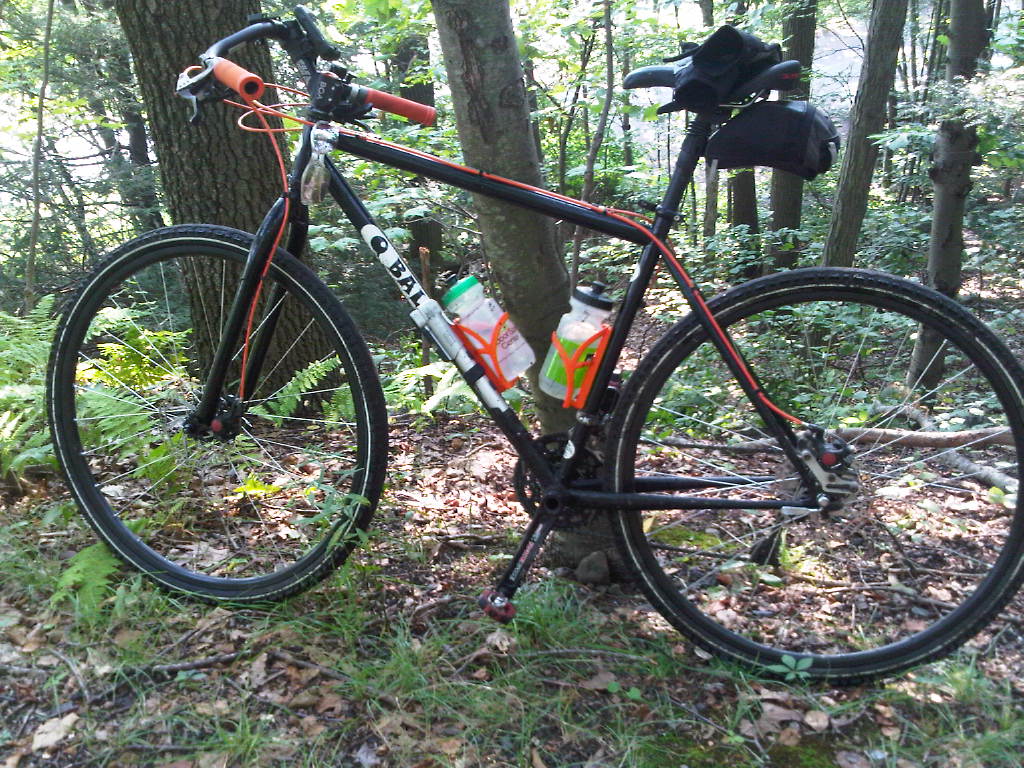
I decided I didn't want the added absurdity of taking the orange beast (not that I haven't in the past), so I wrestled the Dawg out of the garage for the occasion. (To see the state of the garage is to understand.) Stopped for a quick photo of Towantic Pond (and to fix one of the straps on the Maxpedition pack).


Saturday, August 23, 2014

Larkin State Bridle Trail

Date: Aug. 23, 2014
Report Type: TA Report
Trail Name: Larkin State Bridle Trail
Town: Naugatuck to Southbury
Trail Conditions: Dry and ready to ride
Observations/Information: The Larkin Bridle Trail was dry today and had assorted people enjoying it: equestrians, bikers, dog walkers, and joggers. There are two problem sections on the trail with regard to water. The second rock cut when coming from the Rt. 63 trailhead in Naugatuck is often muddy. That section was dry and firm. Near Townantic Hill Road, there is often 2 inches of water running across the trail. That section was merely tire-sucking mud. The trail surface seemed better maintained than my last ride in 2011. In many areas, the trail is narrow due to overgrowth of all the weeds. Two years ago, I do not remember seeing any Japanese knotweed. Now, it is growing prolifically along many areas of the trail. With my group, we got off the trail to ride to Rich Farm on Rt. 67 for ice cream. When heading toward Naugatuck, turn right on Christian Street, and then next right on Towner Lane. At Rt. 67, turn left and the farm is on the right in 0.3 miles. Route information for the main route at http://connect.garmin.com/modern/activity/90110959. Route information for the loop including Rich Farm at http://connect.garmin.com/modern/activity/572089462.
Download a map from the state website at www.ct.gov/deep/cwp/view.asp?A=2716&Q=434808.
Trail Ambassador Name: Tom Ebersold
Trail Ambassador E-mail: bikehikekayak123 [at] sbcglobal [dot] net
How did you use the trail? MT Biking
Trails Ridden: Larkin Bridle Trail
Time of day: Morning
Time/Duration (hours): 3 hours
Approximate Distance (Miles): 25 miles

Saturday, July 26, 2014

Larkin State Bridle Trail

UPDATE 2014-Aug-2: Signs are down, so I'm guessing it is open again.  I'll ride out there in the next day or two to be sure.


The Larkin State Bridle Trail is CLOSED between Riggs St. and Christian St. in Oxford due to power line work.

Detour is Riggs -> Jack's Hill -> Commerce -> Christian (or its reverse).  Caution: Christian is also under construction.


Friday, April 25, 2014

Larkin State Bridle Trail

Date: 4/25/2014
Report Type: TA Report
Trail Name: Larkin State Bridle Trail
Town: Oxford
Trail Conditions: The usual melange

Observations/Information: I had a meeting with a client on Hurley Road, so given the weather we're supposed to be getting this weekend, took the opportunity to ride up and back and get something in. Ride(s) on the trail between the Riggs Street and Pope Road crossings.

Mostly "As Usual" - the wet spot on the Riggs side of the power lines was wet; the sandy spot on the other side of the power lines was sandy. New crushed stone under the ISO RoW, probably for the new power tower work. Also a bit of wet the Hawley end of the stretch between Hawley and Pope. Poop and hoof prints = Bridle Trail (duh).

Branches across the trail towards the Hawley end of the Christian-Hawley segment. I took down the smaller piece (which was the major problem in terms of trail obstruction) on my return ride. (It was there when I took stepdad riding a couple weekends ago - couldn't clear it then, due to time constraints.) Will need to return for the bigger branches with someone else to assist.

A few walkers/joggers, and someone on a comfort bike. I asked one of the joggers if he dropped a sweatshirt a ways back (not far, few hundred yards) - he had.

Trail Ambassador Name: John Joy
Trail Ambassador E-mail: jmj [at] savagejoy [dot] com
How did you use the trail? MT Biking
Trails Ridden:
Time of day: Afternoon
Time/Duration (hours): 1 (I think,  excludes road riding to get there)
Approximate Distance (Miles): Approx. 10 (5 each way - again not counting the road)

Sunday, November 3, 2013

Larkin State Bridle Trail


Date: 11/3/2013
Report Type: TA Report:
Trail Name: Larkin State Bridle Trail
Town: Oxford/Middlebury/Naugatuck
Trail Conditions: Good

Observations/Information: Took a quick ride this morning on the east end (Riggs Street to Route 63 and back). The leaves and light overnight rain made the sandtraps almost pleasant, and the general dry trend we've been having meant even the typically mucky places weren't.


Nothing major to report TM-wise, except a tree down across the trail just east of the Allerton Farms Road crossing that was too big for my hand saw.


Also some evidence of dirt bike activity


Saw some joggers and dog walkers, but no two wheel or equine users (though some places were a bit bumpy from hoofprints - and had to do the usual road apple dodging - so you know they've been there).

Trail Ambassador Name: John Joy
Trail Ambassador E-mail: jmj [at] savagejoy [dot] com
How did you use the trail? MT Biking
Trails Ridden:
Time of day: Morning
Time/Duration (hours): 1.25 hours
Approximate Distance (Miles): 10 mi (5 mi each way)

Sunday, August 4, 2013

Larkin State Bridle Trail

Date: 8/4/2013
Report Type: TA Report:
Trail Name: Larkin State Bridle Trail
Town: Naugatuck/Middlebury/Oxford/Southbury
Trail Conditions: Good
Observations/Information: Yup, it's still there. 8^)

Seriously, though, the mucky spots are still mucky, the sand traps still sandy, the washed-out part west of Route 67 is still rough, … Only a few items of note:

The vegetation is growing in here and there. (Almost felt like singletrack in a few places it shouldn't.)

There's a broken branch dangling above the trail just east of the South Street crossing.

The segment from Jeremy Swamp Road out to Kettletown Road is washed out a bit (both at the hill up from the road, and the Kettletown end of the trail).

Rode from Riggs Street eastbound to Route 63, back again westbound to Kettletown Road, then back to Riggs Street (and home). Performed very minor trail maintenance consisting principally of trimming some branches and/or moving branches someone cut previously a bit further off-trail.

Saw one fellow rider, one equestrian, and a smattering of dog-walkers and joggers.

Trail Ambassador Name: John Joy

Sunday, May 19, 2013

Larkin State Bridle Trail


Date: 5/19/2013
Report Type: TA Report:
Trail Name: Larkin State Bridle Trail
Town: Naugatuck/Middlebury/Oxford/Southbury
Trail Conditions: Good (mostly)
Observations/Information: Rode end to end and back (actually started/ended near midpoint @ the Riggs Street crossing). Light drizzle (hey - that's what GoreTex is for), encountered a couple joggers and dog-walkers, but no other bikes or horses (though there was plenty of, um, evidence of equestrian use). Some evidence of motorbike activity, especially at the Naugatuck end.

Trail condition is good for the most part. Just in from the Naugatuck terminus @ Route 63 there's a large mucky patch that has been repeatedly ridden through.
The segment in Oxford between the Towantic Hill Road and Longmeadow Road crossings is still closed (private property), necessitating a detour onto those two roads. (This I confirmed with DEEP.) Towantic, in particular, is steep and curvy (with horrible sightlines) and heavily traveled, so use caution.

Sandy patches in Oxford by Towantic Pond and just west of the power line crossing by the airport. Wet area just to the east of the power line crossing.
The segment in Southbury between Route 67 and Curt Smith Road was washed out by the big rains a couple years back; the trail meanders in and out of what appears to be a rocky streambed (presently dry for the most part).

Just in from the Southbury terminus @ Kettletown Road there is a blowdown across the trail that's a bit too big for my small handsaw. I did manage to cut the narrow end, but by myself (and coming off a back injury) couldn't get it dragged off trail. Will have to return with tools and/or help.

Most of the storm blowdowns have been cleared. There are a few leaners (including an ominous looking one just in from the above in Southbury).

Trimmed a branch partially obstructing the trail in Oxford.
Trail Ambassador Name: John Joy

Sunday, April 14, 2013

Larkin State Bridle Trail

Date: 4/14/2013
Report Type: TA Report:
Trail Name: Larkin State Bridle Trail
Town: Oxford/Southbury
Trail Conditions: Good
Observations/Information: Quick Sunday AM ride out to Southford Falls and back via the Bridle Trail (Riggs Street to Route 188 only). Looks like some users (bike and equestrian) were on it soon after the big rains last week and left mild rutting/hoof marks in places. The wet spot east of the power line crossing is still wet.

Cleared a branch across the trail that had been there since at least my last ride out that way, on St. Pat's.
Trail Ambassador Name: John Joy

Monday, November 26, 2012

Larkin State Bridle Trail


Date: 11/24/2012
TA Report
Trail Name: Larkin State Bridle Trail
Town: Oxford/Naugatuck
Trail Conditions: Leafy, still wet in the usual places.


Observations/Information: The trail is BLOCKED between Long Meadow Rd and South Street!


Trail Ambassador Name: Mark Lurie
Trail Ambassador E-mail: ctnemba a la gmail dot com
How did you use the trail? Monster Cross
Time of day: Morning
Time/Duration (hours):  2
Approximate Distance (Miles):  19

Sunday, August 21, 2011

TA Report: Larkin State Bridle Trail

Monster Cross

Date: 8/21/2011
Report Type: TA Report:
Trail Name: Larkin State Bridle Trail
Town: Southbury, Oxford, Middlebury, Naugatuck
Trail Conditions: Some mud, mostly OK

Observations/Information: Rode the entire length of the Larkin on the Monster Cross this morning. Looks like the State finally took care of that blow down near Kettletown Road and it looks like several sections got regraveled. Watch out for sand though, there are quite a few sandy spots.


Right before Towantic Hill Rd there is a huge, deep puddle, and after the road crossing stream going through the trail is running profusely. Stay down the middle until you see the gravelly banks and use them.
Trail Ambassador Name: Mark Lurie


Sunday, June 5, 2011

TA Report: Larkin State Bridle Trail


Date: June 4, 2011
Report Type: TA Report
Trail Name: Larkin State Bridle Trail
Town: Naugatuck, Middlebury, Oxford, Southbury
Trail Conditions: Varied
Observations/Information: The Larkin Bridle Trail offers up a bit of everything in its surface. Some sections are hard packed cinders. Other parts have sand pits due to erosion, and the damage from horse hooves. One section that is privately owned is perpetually under 2 inches of water. A section near Rt. 67 is a rock garden, due to heavy erosion. Some of the road approaches are steep and technical. None of the original bridges or tunnels are in place, so there are numerous road crossings, most fairly quiet. On this trip, I noticed three significant washouts that were not present last year. I reported them to the state with the hope the DEP can repair them. There were numerous equestrians on the trail, as one might expect, plus assorted dog walkers and joggers, bikers, and unfortunately, two people on dirt bikes. There are many side trails off the bridle trail, but I have never explored them. The trail section between Long Meadow Road and Towantic Road is privately owned. The story that I got from an equestrian is that the property owner does not want to see the property to the state and the state does not want to get involved with eminent domain, but the property owner does not mind people riding across the trail

The state has two small faded signs at these roads, telling people to use the road to by-pass this section of trail. Unless you looked for the signs, you would never see them, and the state shows a continuous trail on the map. Signs at trail crossings say, "No vehicles," but should be amended to read "No motorized vehicles," since the state website makes it clear that bicycles are allowed. Map and other info at www.ct.gov/dep/cwp/view.asp?A'16&QC4808.
Trail Ambassador Name: Tom Ebersold

PS----


Can you update my recent entry with this info from Nate Hale, the park supervisor for the Larkin:Begin forwarded message:> We are aware of several washouts from the March rain event, we are in the process of fixing the biggest at Southford and hope to have sufficient ,materials from that job to repair these as well within the next week or so.